21st Sep, 2019 10:00
Fine Art, Antiques & Jewellery including a large Collection of Martin Brothers Pottery

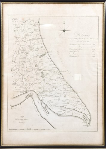
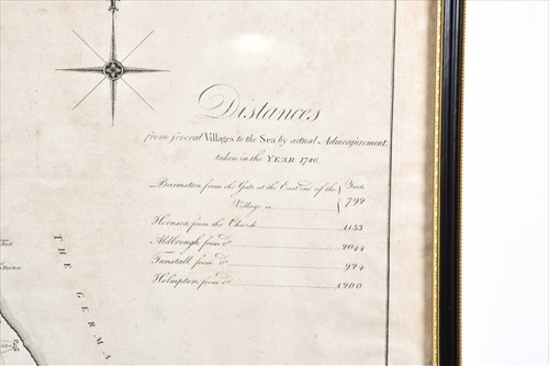
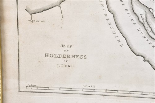
Tuke (John): 'Map of Holderness' dated 1786, engraved map, the paper bearing a watermark (indistinct'), compass rose and table of 'Distances from several Villages to the Sea', 62 cm x 48.8 cm, glazed in an ebonised frame.
Sold for £70
Tuke (John): 'Map of Holderness' dated 1786, engraved map, the paper bearing a watermark (indistinct'), compass rose and table of 'Distances from several Villages to the Sea', 62 cm x 48.8 cm, glazed in an ebonised frame.

